The National Center for Meteorology (NCM) in Saudi Arabia has begun issuing specialized climate maps for rain distribution as part of its efforts to enhance climate monitoring and analysis tools, and to strengthen the early warning system. These maps are part of the center's strategy to provide advanced climate products based on accurate data and scientific analysis that supports decision-making and enhances public safety.
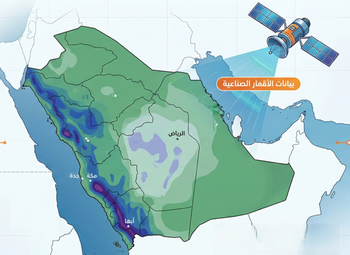
A rain distribution map for April has been released, covering the historical period from 1998 to 2025, based on data analyzed from satellites. The map shows higher concentrations of rain during April in the southwestern regions and western highlands of the Kingdom, while light rain extends to some central areas, with other regions experiencing varying levels of precipitation.
Details of the Initiative
This initiative aims to improve preparations for rain events by providing relevant authorities with effective tools for weather forecasting. Climate maps are considered a key tool that supports the early warning system, enabling authorities to take proactive measures to improve responses to climate events.
The National Center for Meteorology has confirmed that these maps will help improve the ability to predict rainfall, contributing to reducing risks associated with floods and severe weather conditions. This step also reflects the center's commitment to providing accurate and reliable information to citizens and government entities.
Background & Context
The Kingdom of Saudi Arabia faces multiple climate challenges, including floods and sandstorms. Historically, rainfall has been unevenly distributed, leading to an urgent need for better monitoring systems. In recent years, the government has taken serious steps to improve climate infrastructure, including the use of modern technology in climate data analysis.
By utilizing satellite data, the National Center for Meteorology seeks to provide accurate information that aids in urban planning and better management of water resources, reflecting the importance of preparedness for climate changes.
Impact & Consequences
This step is extremely significant in the context of climate change, which affects all countries worldwide, including Saudi Arabia. By improving the early warning system, damages from floods can be minimized, helping to protect lives and property. Furthermore, this initiative enhances the Kingdom's ability to face future environmental challenges.
Moreover, improving the climate monitoring system can contribute to promoting sustainable development in the Kingdom, as climate data can be used to enhance agriculture and manage natural resources. This step also reflects the Saudi government's commitment to achieving the goals of Vision 2030 in the fields of sustainable development and innovation.
Regional Significance
Many Arab countries share climate challenges, suffering from scarce water resources and changing rainfall patterns. Successful experiences in Saudi Arabia could serve as a model for other countries in the region, contributing to enhancing regional cooperation in climate monitoring.
In light of increasing climate changes, developing effective early warning systems can have a significant impact on food and water security in the region, enhancing the stability of Arab countries and reducing risks associated with severe weather conditions.
The launch of rain distribution maps by the National Center for Meteorology represents an important step towards improving preparedness for climate challenges. This initiative not only enhances the Kingdom's ability to deal with rains but also contributes to strengthening regional cooperation to face climate changes.