The U.S. administration has asked relevant authorities to block satellite images related to the conflict in Iran, sparking widespread debate about the role of these images in uncovering truths that governments attempt to conceal, especially during times of crisis and war. Satellite images are a vital tool for monitoring events, providing accurate information about military movements and strategic locations.
This request comes at a sensitive time as tensions between Iran and the United States escalate, increasing the importance of publicly available information. Blocking these images may be seen as an attempt to control the media narrative and shape public opinion, which raises concerns among many experts and analysts.
Details of the Request
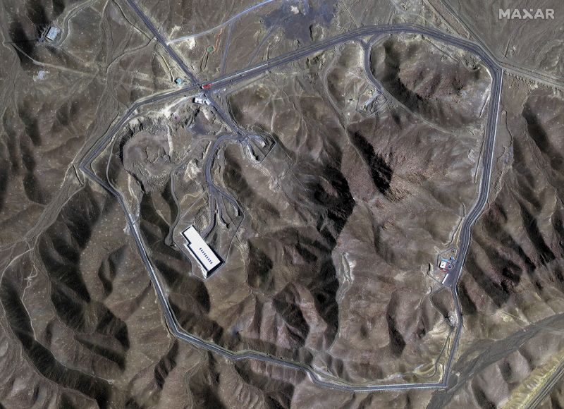
In the context of the ongoing conflict, satellite images play a crucial role in documenting events and providing visual evidence of what is happening on the ground. Reports have shown that these images have contributed to revealing many truths about Iranian military activities, including troop movements and the distribution of military equipment.
On the other hand, the request to block these images reflects the U.S. administration's concern about their use as a tool for criticizing its policies. As Washington seeks to strengthen its position in the region, this move could exacerbate tensions rather than ease them.
Background & Context
Historically, satellites have been used as a tool for gathering intelligence, proving effective in numerous conflicts around the world. In the case of Iran, these images are essential for understanding the military and political dynamics in the region. Since the conflict began, there have been multiple attempts by governments to restrict access to information, raising questions about transparency and credibility.
Concerns are growing that blocking information could lead to the spread of misinformation, as the public relies on visual sources to understand events. Under these circumstances, it becomes crucial to enhance transparency and provide accurate information to the public.
Impact & Consequences
This move could have serious repercussions for international relations, reflecting a lack of trust between governments and their citizens. As the United States seeks to bolster its position in the Middle East, attempts to block information may worsen crises instead of resolving them.
Moreover, blocking information could contribute to increasing tensions between Iran and Western countries, potentially escalating the conflict. In such circumstances, it is essential to have mechanisms in place to ensure the free and accurate flow of information.
Regional Significance
The Arab region is significantly affected by the U.S.-Iranian conflict, as events in Iran play an important role in shaping regional policies. Blocking information may influence how Arab countries perceive events, leading to uninformed decision-making.
Ultimately, there must be a balance between national security and the public's right to know. Promoting transparency and providing accurate information is the only way to ensure regional stability and avoid exacerbating crises.