The National Center of Meteorology in Saudi Arabia has initiated the release of specialized climate maps for rainfall distribution, as part of its ongoing efforts to develop monitoring and climate analysis tools and enhance the early warning system. This step is part of the center's strategy to provide accurate and reliable data that supports decision-making related to weather phenomena.
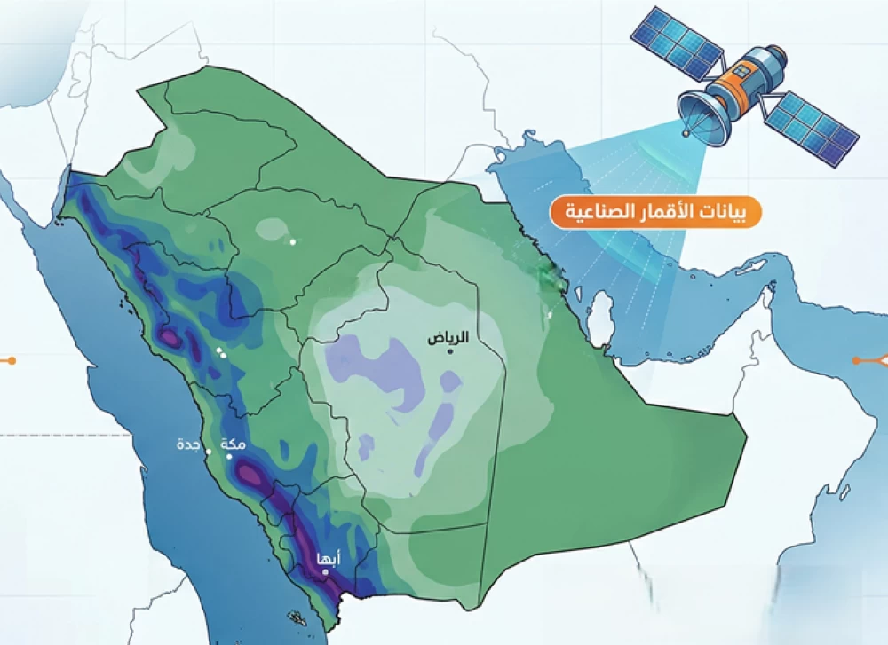
The newly released climate map covers the month of April for the historical period from 1998 to 2025 and is based on satellite data analyzed by the center. The map shows a concentration of rainfall with higher amounts during April in the southwestern and western highlands of the kingdom, while lower amounts extend towards parts of central Saudi Arabia. Meanwhile, the rest of the regions experience varying degrees of rainfall.
Details of the Initiative
These climate maps are considered an effective tool to support the early warning system, enabling relevant authorities to take precautions and proactive measures to deal with rainy conditions. They also contribute to enhancing preparedness and effective management of various weather phenomena, thereby strengthening the kingdom's ability to face climate challenges.
This initiative comes at a time when the world is witnessing rapid climate changes, necessitating intensified efforts to develop monitoring and analysis tools. Through these maps, the center aims to provide accurate information that supports planning and sustainable development across various sectors.
Background & Context
Historically, Saudi Arabia has experienced significant climate fluctuations, being affected by drought waves and heavy rains at varying intervals. In recent years, the importance of climate monitoring has increased in light of global climate changes, prompting the National Center of Meteorology to take proactive steps to enhance its capabilities in this field.
Accurate climate data is essential for guiding public policies and planning development projects, especially in agricultural and water sectors. Therefore, developing monitoring and climate analysis tools is a strategic step that contributes to improving the quality of life in the kingdom.
Impact & Consequences
These maps are expected to improve the response of relevant authorities to rainy conditions, thereby reducing potential risks to the population and infrastructure. Additionally, strengthening the early warning system can help mitigate damages caused by floods or storms, positively impacting the national economy.
Moreover, this initiative reflects the kingdom's commitment to achieving sustainable development goals by enhancing its ability to adapt to climate changes. It also contributes to raising community awareness about the importance of climate monitoring and its impact on daily life.
Regional Significance
Saudi Arabia is considered a leading country in climate monitoring in the region, and this step may enhance regional cooperation in the exchange of climate data and information. Given the climate challenges faced by many Arab countries, developing monitoring and analysis tools can have a positive impact on crisis response levels.
This initiative could also encourage other countries to take similar steps, contributing to building a network of regional cooperation to collectively face climate challenges. Ultimately, enhancing climate monitoring and analysis capabilities is a necessary step to ensure a secure and sustainable future for the region.